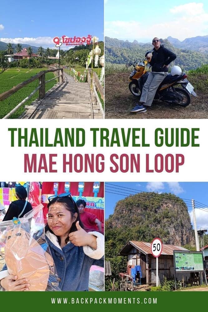
Mae Hong Son Loop: The Full Guide
This post may contain affiliate links. If you make a purchase using one of these links, I may receive a small reward at no extra cost to you. See my Disclosure Policy for more information.
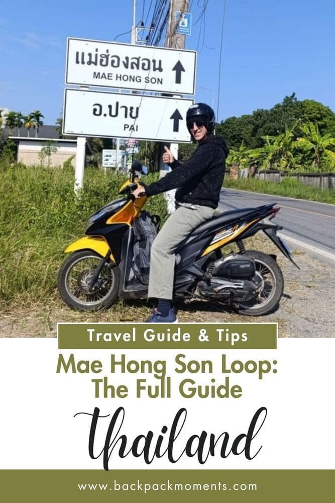
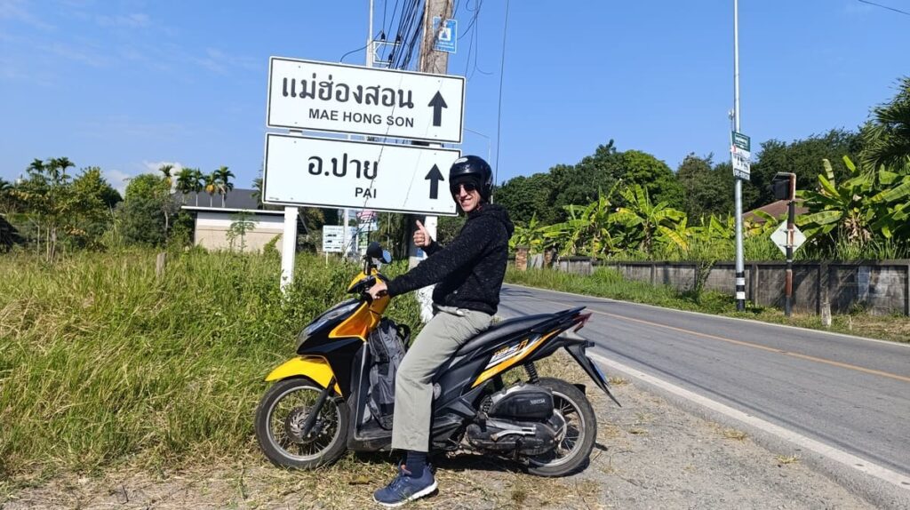
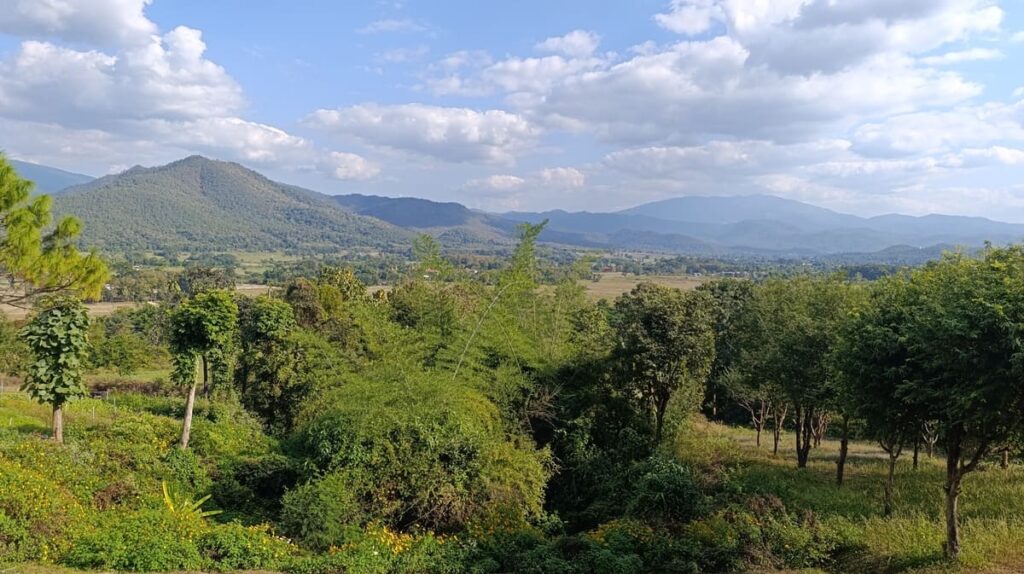
The Mae Hong Son Loop is a winding, mountainous route in northern Thailand best done on a motorcycle.
This 400-700 kilometer loop is packed with jungle roads, misty hills, friendly villages, rice paddies, and more bends than your handlebars can handle.
Literally.
There are 1,864 of them. Someone counted.
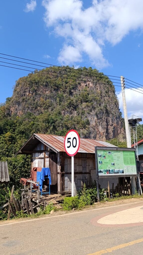
It normally starts and finishes in Chiang Mai. The route takes you through sleepy Pai (which is not nearly as sleepy as it once was), the silent Mae Hong Son town, and several other smaller towns and villages.
Oh, and because this is northern Thailand? The roads are actually paved. Mostly. You’re gonna love it.
It’s equal parts fun, cultural, and absolutely stunning. You don’t need to be Rossi to ride it, but you do need to know what you’re in for.
So here’s the full guide to the Mae Hong Son Loop!
Mae Hong Son Loop Quick Facts
- Time needed: 4 to 6 days (3 if you’re insane, 7+ if you’re chill).
- Distance: ~400-700 km, depending on route and side trips.
- Attractions: Waterfalls, hot springs, forest temples, cave systems, rice terraces.
- Difficulty: 3/5
- Cost: 1000-1300 THB per day
- Best Season: November to February (dry, cool, clear views)
Mae Hong Son Loop Maps
I used Maps.me almost exclusively.
Many roads that do not exist on Google Maps are shown on Maps.me. Moreover, it has a lot of useful pins left by other users – from viewpoints, to waterfalls and cafés.
Google Maps is great when it comes to reviews on places (to get an idea if it’s worth it or not) and generally better for navigation on bigger roads. I still prefer Maps.me, though – it works like a charm offline too (just download the map)!
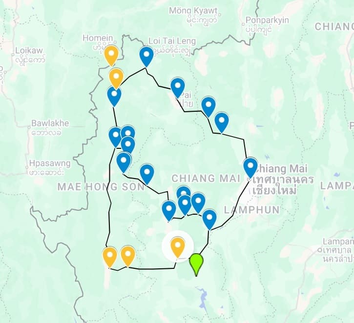
The classic loop is clockwise, but counter-clockwise is equally doable.
How Many Days Do You Need?
You can blitz through the Mae Hong Son Loop in 3 days. You shouldn’t.
How many days you need largely depends on how fast you like to travel, and how many butt breaks you want to take.
3 days is for the masochists. You will be driving way too much to enjoy anything. Perhaps do it for the achievement, though even then, it’s better to do a section of the loop, say from Chiang Mai to Pai, plus a day trip on Day 2, and go back.
4 days is for the fast & functional. You can do the Loop, stopping at Pai, Mae Hong Son, and Mae Sariang, but you will have long days on the saddle and less time for sights and breaks.
5 Days is the sweet spot. It’s balanced and an ideal mix of riding and sightseeing. You will have time for detours and make a stop at Doi Inthanon on the way back. You still need a decent riding stamina, though.
Doing the Loop in 6-7 days qualifies you as a chill backpacker. You can get extra nights in places like Pai or Mae Hong Son and extra time to linger or do side quests.
Sample 5-Day itinerary at a glance (suggested route)
Five days is the most popular length for the Mae Hong Son Loop. Later in the article, you will see suggestions for alternative routes and detours, plus recommendations for what to see and where to stop.
Here’s the suggested route we drove, circling Mae Hong Son province, in January 2025.
- Day 1: Chiang Mai to Pai (~130 km): Popular stretch, curvy, picturesque.
- Day 2: Pai to Mae Hong Son (~110 km): Mountainous terrain, caves, vistas.
- Day 3: Mae Hong Son to Mae Chaem (~180 km): Best day ever, amazing and solitary roads.
- Day 4: Mae Chaem to Doi Inthanon (~35-55 km): Thailand’s highest peak and the surrounding national park.
- Day 5: Doi Inthanon to Chiang Mai (~100 km): Return to the city.
Day 1: Chiang Mai to Pai
- Distance: ~130 km
- Ride Time: 3–5 hours (depending on stops, weather, and how corner-happy you are)
- Road Type: Fully paved, narrow in places, 762 curves (yes, really)
This is the most famous stretch of the Mae Hong Son Loop.
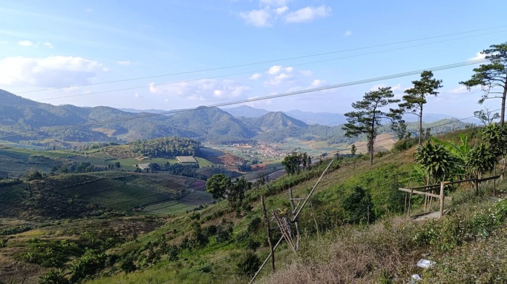
And for good reason. The road from Chiang Mai to Pai is a non-stop rollercoaster of switchbacks, beautiful scenery, plus 180+-degree vistas (though often misty), and the occasional truck crawling uphill at 20 km/h.
If you’re new to riding, this stretch will baptize you in asphalt and adrenaline. If you’re experienced, it’s motorcycle heaven. Just keep your eyes on the road. Travel this section in a van, and there is a non-zero chance you will puke by curve #300.
You’ll see signs counting the turns like it’s some kind of warped carnival ride: “Curve 198,” “Curve 511,” etc. You can even get a certificate of achievement in Mae Hong Son for the full 1864 turns.
It’s not a long day in terms of kilometers, but it’s tiring. Take it slow, take breaks, and enjoy the ride.
Suggested Stops
- Mok Fa Waterfall: (~50 km from Chiang Mai): before the real mountainous section begins. 100 THB fee for foreigners – if you’ve seen a fair share of waterfalls, entirely skippable.
- Pong Duet Hot Springs (~60 km from Chiang Mai): A quiet, steamy stopoff with geysers, walking trails, and a mineral bath. 300 THB entry fee, but it’s a legit jungle hot spring, not a concrete tub.
- Kiew Lom Viewpoint: Panoramic rest stop halfway up the mountains. You’ll want photos. There’s usually grilled corn or coffee here too. Simple but scenic.
- Coffee in Love (just before Pai): A totally touristy coffee shop with pretty views of Pai Valley. Good place to stretch, caffeinate, and rest your arms – not that you have much more to go after that.
Arrival in Pai
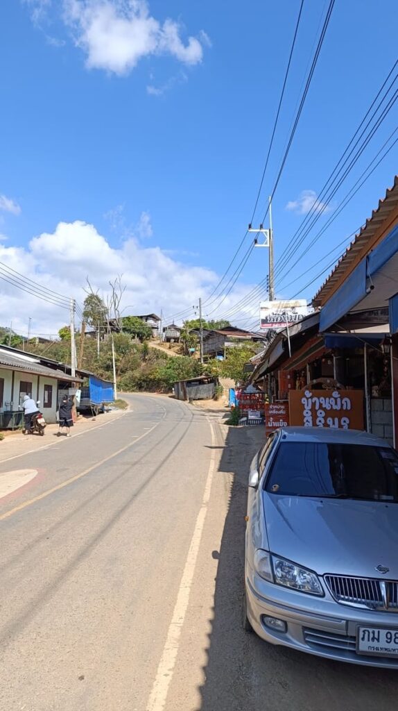
Pai is a former hippie enclave turned backpacker jungle party zone.
Some still rave about how it’s the best place in the universe. I don’t get the hype – there are more farangs than locals, and it’s not even that charming. I wouldn’t spend a month there but to each their own.
The town sits in a lush valley with rice paddies, bamboo bungalows, and banana pancake energy. You’ll find street food, reggae bars, waterfall hikes, and 10 different places offering kombucha.
Don’t miss Pai’s walking street market. Stalls pop up starting from around 5 pm. You can find the usual honeyed pork sticks, sushi trays, mango sticky rice, and other grilled, fried, or sugary goods.
Where to Stay
- Budget: Pai Country Hut. Bamboo huts by the river, super chill.
- Boutique: Reverie Siam. tasteful and bougie, but with a price tag to match.
- Social: Revolution Hostel Pai. Classic party hostel. Best if you want to meet every backpacker in town and don’t value your sleep all that much.
Day 2: Pai to Mae Hong Son
- Distance: ~110 km (+ optional 50 to Ban Rak Thai).
- Ride Time: 3-4 hours.
- Road Type: Excellent mountain tarmac with fewer tourists and more solitude.
- Vibe: Jungle, curves, misty peaks, a giant cave system, a unique border town, and the quietest provincial capital in Thailand.
Overview and options
After a banana pancake breakfast in Pai (or noodle soup, if you want a more local way to start the day), it’s time to hit the road again.
This stretch is a stunner! You’ll cut deeper into the highlands, with fewer backpacker vans, more forest, and better riding flow. The curves are still coming thick and fast, but the traffic thins out, and the scenery opens up. It’s greener, higher, and wilder.
Today is also cave day. Tham Lod Cave is one of the biggest cave systems in northern Thailand, and it’s absolutely worth the detour.
Add in bamboo rafting through the cave (yes, inside it), and it becomes a loop highlight. I had already been to Kong Lor Cave in Laos, a similar experience, and decided to skip Tham Lod.
A short 3-km detour to Ban Ja Bo is 100% worth it. It’s a tiny village built on a cliff. Sit down at one of the coffee houses for a break with a view.
After descending from the mountains near Ban Mok Cham Pae, you have a choice to make: Go to Ban Rak Thai or cut your driving short by proceeding directly to Mae Hong Son.
Ban Rak Thai hugs the Thai-Burmese border, and many consider it the most beautiful place in Thailand. A lake surrounded by misty hills is the main highlight, apart from the inevitable souvenir vendors.
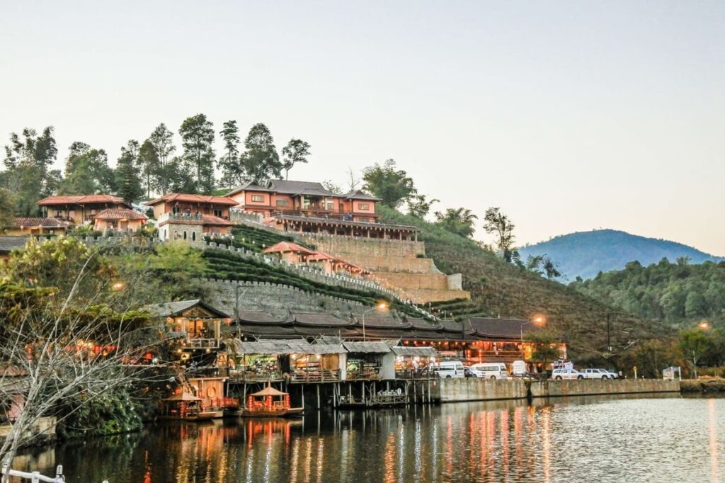
It is a little bit plastic, i.e., fake, and certainly molded into a polished attraction, though below the surface, locals retain their Yunnanese culture of tea farming, unique food, and language.
Mae Hong Son town, your destination, is very different from Pai. Provincial is perhaps the best word to describe it. It’s beautifully Thai with a touch of Burmese influence in its temples.
The vibe is peaceful, the lake is postcard-worthy, and the crowds are blissfully absent.
Suggested Stops
- Lod Cave / Tham Lod (Soppong) (~50 km from Pai): A massive limestone cave with prehistoric coffins, bats, and a bamboo raft you ride through the darkness. Guided tours only – about 400 THB for two people with a lantern-carrying local guide.
- Pang Mapha Viewpoint
- Ban Ja Bo village and viewpoint
- (Optional) Ban Rak Thai: requires a 50 km detour return.
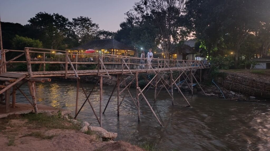
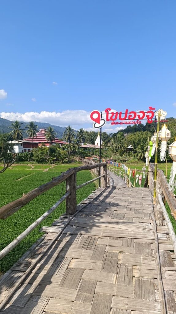
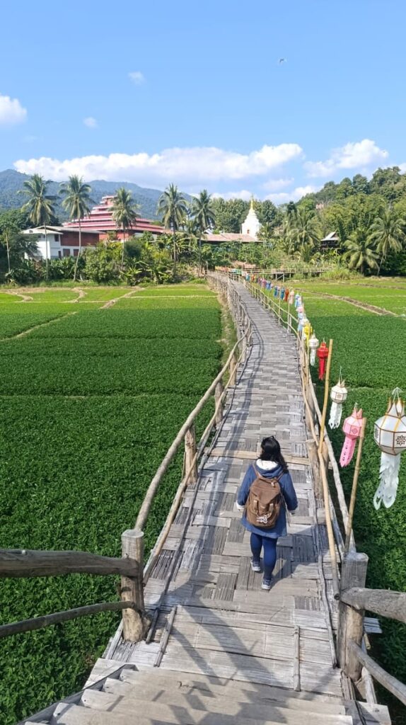
- Sutongpe Bamboo Bridge (near Mae Hong Son): A 500-meter bamboo bridge over rice fields leading to a monastery. Very photogenic.
Arrival in Mae Hong Son
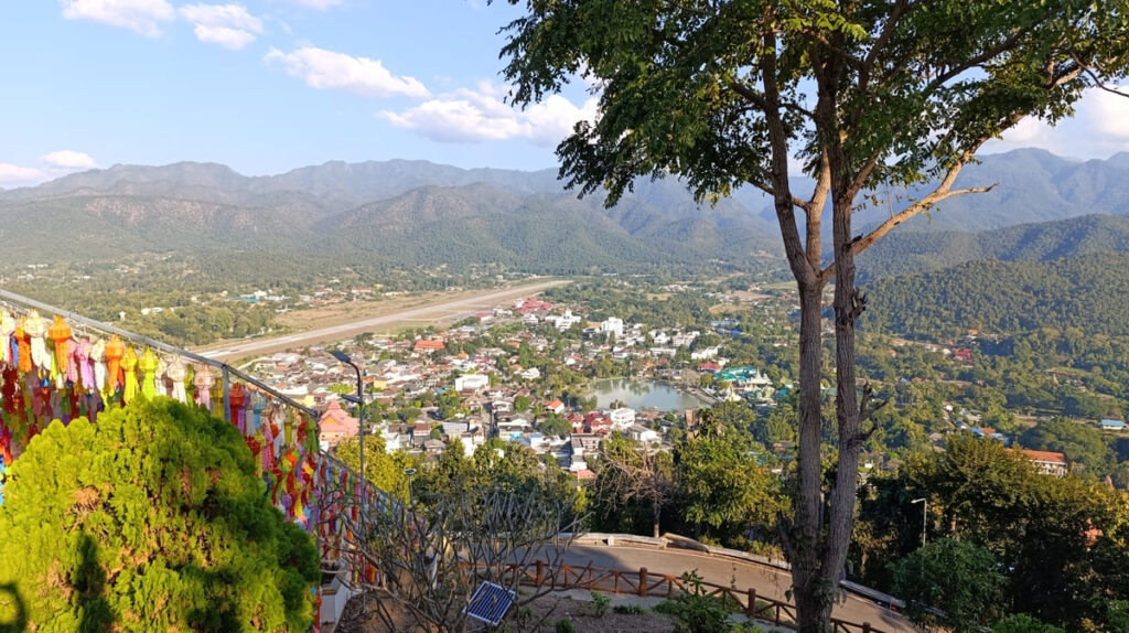
This is the provincial capital and the namesake of the Loop. It is a bit sleepy – everything revolves around the Jong Kham Lake in the center and the hilltop Wat Phra That Doi Kong Mu, which lights up at night.
There’s no party scene here – total opposite of Pai.
The Mae Hong Son Night Market is located by the lake. It is small – just a dozen or so stalls. You will find the usual northern specialties like khao soi, sai oua (northern sausage), and grilled sticky black rice.
Some vendors also sell Burmese-style curries and tea leaf salad, a nod to the nearby border, and the many immigrants/refugees that have crossed it over the past 50+ years.
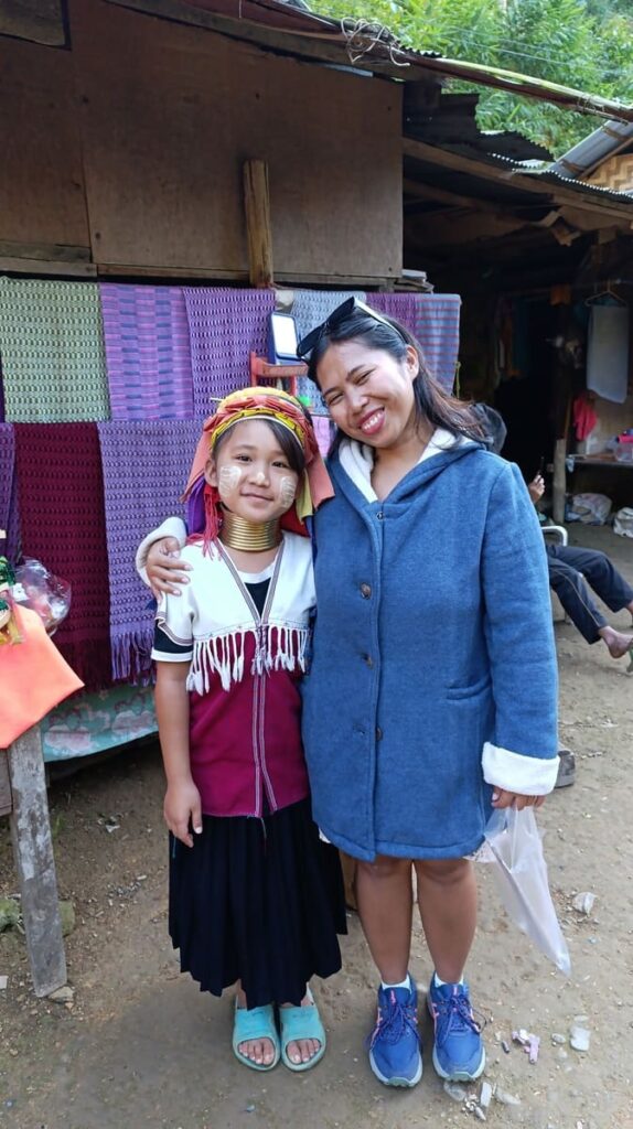
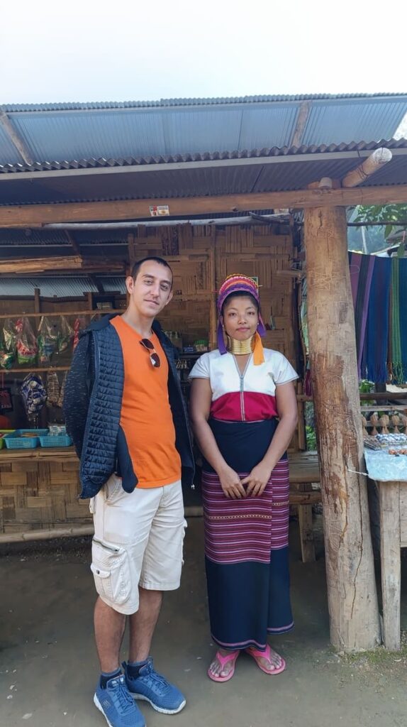
Talking of refugees, there are several Karen villages in the region. Is it ethical to visit them? Read my take on the topic in a dedicated article.
We visited the Kayan Taryar Karen village [map] – ostensibly a very regular village. There is no entry fee collected by Thai overlords either. Still, every house doubles as a souvenir shop, so tourists are definitely expected and welcome.
Anyway, it was an eye-opener. Do buy a souvenir if you go and do speak to them to learn more!
Where to Stay
I stayed at Pimpa House, just 10 km south of Mae Hong Son, and oh my, is that place amazing. Impressively clean rooms, an awesome view towards the paddies and mountains in the back, wonderful breakfast, and hot springs (free for feet, super cheap for private baths) just 2 minutes on foot away.
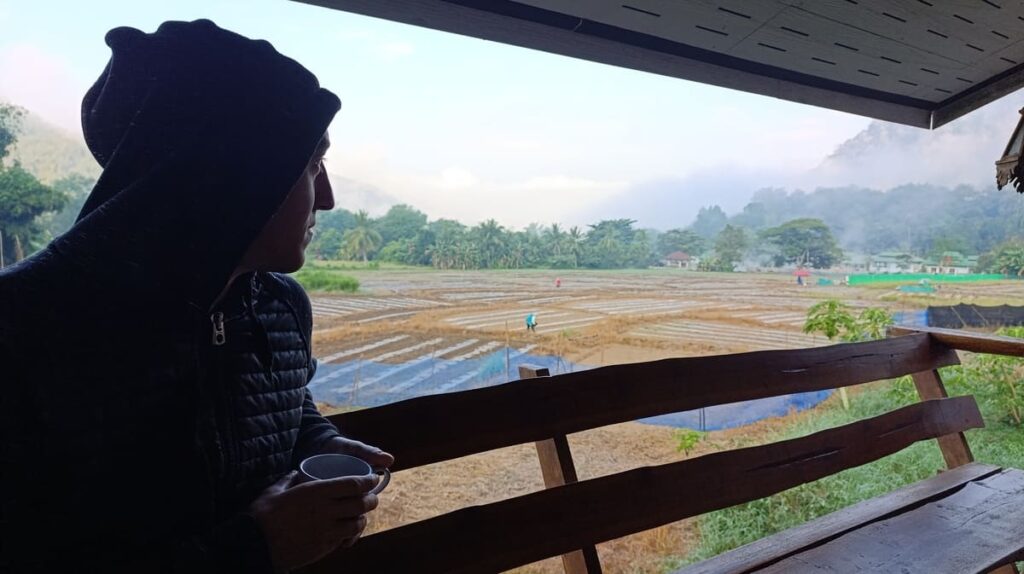
For the price they charge, it’s probably the best value for money. We liked it so much, we decided to stay an extra night before resuming the Loop.
Here are two other good options:
- Budget: Sarm Mork Guest House – right by the lake, simple and clean.
- Chic: Fern Resort – outside town, nestled in nature with rice paddy views.
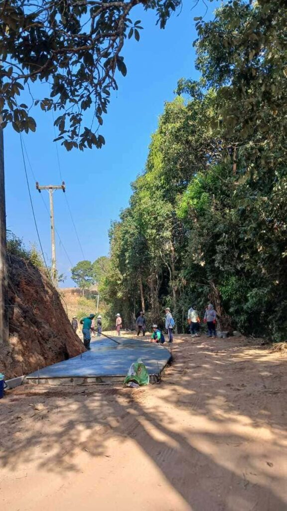
Day 3: Mae Hong Son to Mae Chaem via Routes 4009 & 1263
- Distance: ~180 km
- Duration: 5-6 hours with stops.
- Route Breakdown: Take Route 108 south to Ban Mae Chae, turn onto Route 4009, then follow until Ban Kham Suk and proceed on Route 1263.
- Why not the usual Mae Hong Son route?: Road 4009 is a brand new road and so, so beautiful! Trust me, this way is much more picturesque and exciting!
Leg 1: Leave Mae Hong Son southbound (40 km)
This is the uneventful part. Go south following the main road #108, stopping at the Pha Bong Viewpoint for a short break, until you reach the intersection for Ban Mae Cha.
If you want the vanilla Mae Hong Son Loop, proceed south to Khun Yuam and then onwards to Mae Sariang. But I am warning you – you’d be missing out on a lot of adventure and wonderful motorcycling.
Leg 2: Route 4009 (~55 km)
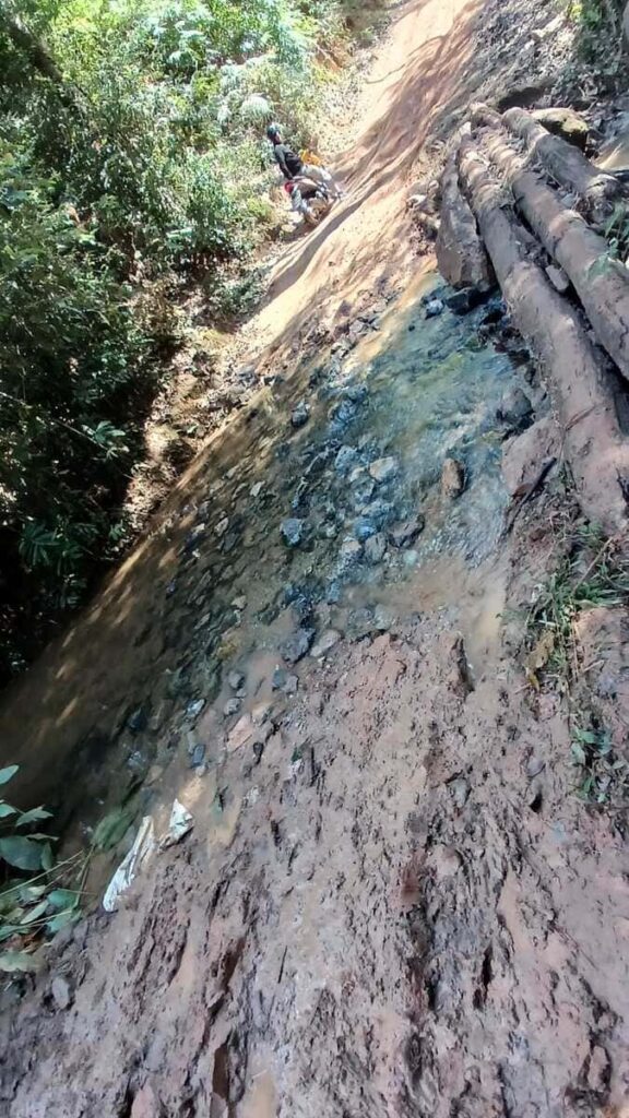
Route 4009 is an absolute gem – steep climbs, thrilling descents, nearly 0 traffic, and stunning views of winding curves and lush hillside farms.
I was a little apprehensive about taking such a small road, but the surface is brand new (2025), and it’s just so pretty! You get very high, very quickly, and the whole mountain is displayed around and below you.
Understandably, there are steep grades (above 10 % in some places) and some tight, serpentine sections.
If you’re riding solo, perhaps 110cc is enough, although I’d suggest not attempting Route 4009 with anything under 125cc. For those riding in pairs, anything under 125cc will not be powerful enough to make the climb in many sections.
Stop for lunch at the lake in Ban Nong Khieow, where you can have an amazing khao soi at one of the small eateries. And amazing pancakes for 20 THB too! Do not linger too much, though, as you still have a lot of riding to do.
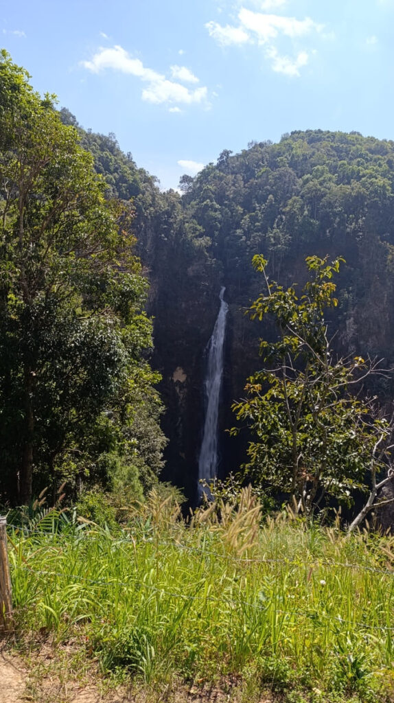
The next notable stop is Mae Surin Waterfall. It’s one of the tallest waterfalls in Thailand, at a height of 180 meters.
The entrance fee for foreigners is 200 THB (locals pay just 40 THB), but you can cheekily avoid it by entering from the exit, since you’re coming from the north anyway. The ethics of that, given the unfair double pricing, I will leave for you to decide.
If in season (Nov to Dec), stop at Thung Bua Tong Fields to see the blooming yellow sunflowers. I was there in early January, and they had all dried out, but I can imagine the fields are very beautiful in full yellow.
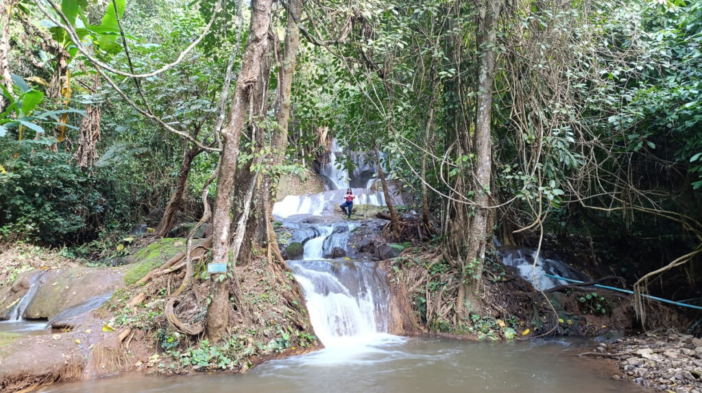
The last stop on the 4009 is the Mae Nam Yuang Waterfall. It’s a set of cascades that you need to walk about 500 meters to reach. It’s a very peaceful place – suitable for a meditation/yoga break or to just have a quick snack (which you have pre-packed, because you’re smart). Entrance is free.
From there, Ban Kham Suk is only about 1 km away.
Leg 3: Route 1263 to Mae Chaem (~85 km)
At the junction with Route 1263, you’ll leave 4009 behind and continue southeast.
The road enters a more relaxing rhythm with the occasional farming landscapes. The undulating terrain is home to many remote hill-tribe villages. Most of them are Hmong.
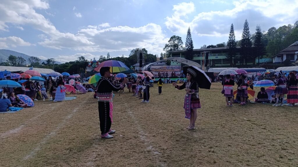
We were lucky enough to come across a massive local Hmong fair in Ban Pang Ung, celebrating Noj Peb Caug – the Hmong New Year.
Celebrations included Hmong music and dances, the “ném pao” (ball throwing) matchmaking game, popular carnival games, and lots of food.
Just watching the people wearing colorful traditional attire is already fascinating enough.


Another place worth visiting if you have spare time is the Huay-Pakkoot Elephant Sanctuary, where more than 40 elephants live in semi-wild conditions.
See my take on the ethics of elephant sanctuaries.
Arrival in Mae Chaem
Approaching Mae Chaem, you will feel the cold seeping from the nearby mountain. It’s a quiet mountain town… ok, I know I’ve called many places so far “quiet” but Mae Chaem, for real, is.
It’s a welcome reward for the day’s adventure.
We stayed at the Kwanlah Homestay, which did a splendid job of warming us up and filling our bellies with an awesome breakfast the morning after.
Day 4: Mae Chaem to Doi Inthanon
Distance: <50 km
Ride Time: 1-2 hours
Road Type: Winding mountain climb with solid tarmac
Vibe: Chilly air, pine trees, epic altitude gain, and Thailand’s rooftop.
Overview
After three curve-heavy days, Day 4 gives your backside a break, but not your brakes – at least not on the way back down.
It’s a short ride up to Doi Inthanon National Park from Mae Chaem, but what it lacks in distance it makes up for in vertical.
You’ll be climbing from about 600 meters in Mae Chaem to over 2500 meters at the summit – the highest point in Thailand.
Pine forests, misty valleys, and way cooler air are the name of the game here. When we were there in early January, it was so foggy and cold that we decided to call it quits and go south of the National Park, through some smaller roads, passing through Op Luang National Park instead.
Big mistake – the roads there are dilapidated at best… I will spare you the details. If you want to skip Doi Inthanon, just go south to Ban Tharuea, where Road 1088 meets Road 108.
Anyway, should you go up Doi Inthanon, wear a jacket. Winter gear is necessary unless you want to freeze to death on the bike.
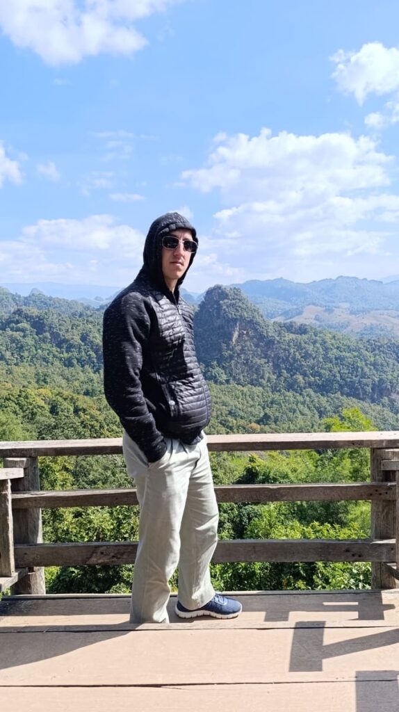
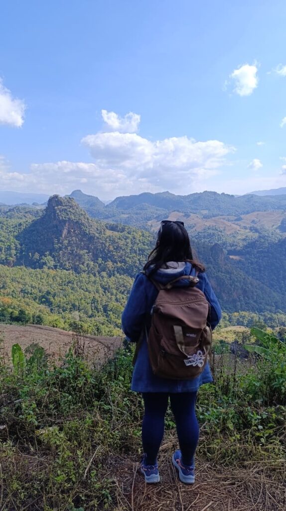
Doi Inthanon – Is the hype worth it?
It’s one of the most famous and popular national parks in Thailand. It can feel quite touristy, especially around the summit, but if you go early to beat the crowds (though in the dark and cold), or explore lesser-known trails like the Kew Mae Pan Nature Trail, it may be worth it.
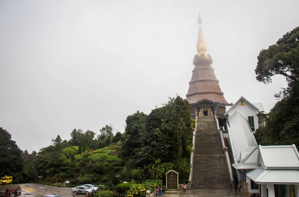
It all depends on your preferences – if you’re after serenity and raw nature, Doi Inthanon will not blow you away, but for a scenic day trip with varied landscapes, it delivers.
As a national park, it carries an entry fee, which is once again hefty for tourists (300 THB) and reasonable for locals (60 THB). Gates open at 5:30 AM and close at 6:30 PM. Keep your receipt – you’ll need it for multiple checkpoints inside the park.
You’d be excused for thinking the entrance fee allows you access to the attractions inside the park. Nope, sorry. The famous Twin Pagodas are another 100 THB; the nature trails also carry a fee (depending on group size); there are fees for entering with a vehicle (30 for car, 20 for motorcycle), and everything else inside the park is severely overpriced.
Well, at least you don’t have to pay extra for the Wachirathan Waterfall.
Yeah, it’s pretty, but it also makes you feel like a walking wallet.
Where to Stay
- In the Park:
- Doi Inthanon View Resort: modest but convenient, impeccable, and comfortable cabins, close to the summit
- Motho Homestay: cabin-style stays surrounded by pine trees. Very romantic!
- Nearby Towns:
- If you want something cheaper, drive to Chom Thong on the eastern slope. This will add around 30 km more driving, though.
Day 5: Doi Inthanon to Chiang Mai
Distance: ~100 km.
Ride Time: 2-3 hours, depending on how long you linger in the park.
Road Type: Smooth descent, highway/wider roads as you exit the mountains.
Vibe: Sunrise summit, lazy ride down, back to reality (and maybe a hot shower).
Overview
The last day on the Loop can be whatever you make of it. You can visit some places within Doi Inthanon that you didn’t manage to do the day before, or go for a hike, or just drive straight back to Chiang Mai.
You can also be a little crazy and drag yourself out of bed for a sunrise mission to the summit of Doi Inthanon. It’s chilly, often misty, and rarely magical.
More of an accomplishment for bragging rights, without any tangible rewards. The view is meh (if any, due to fog), it’s extremely cold before the sun rises, and there’s nothing besides a small plaque at the top.
Suggested Stops on the Way Down
- Mae Klang Waterfall: A powerful multi-tiered fall near the eastern park entrance. It’s worth a short stop if you didn’t get your fill of waterfalls the last few days.
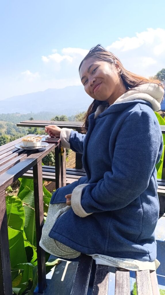
- Local Coffee Shops (Route 1009): There are a bunch of cafes along the descent, usually run by local families with beans grown in the area. Try one with a balcony for last mountain views and a final Thai iced coffee.
- Ban Luang or Chom Thong Markets: These small town markets are full of fruit stalls, snacks, and an interesting look at non-touristy local life. Massively different from Chiang Mai proper.
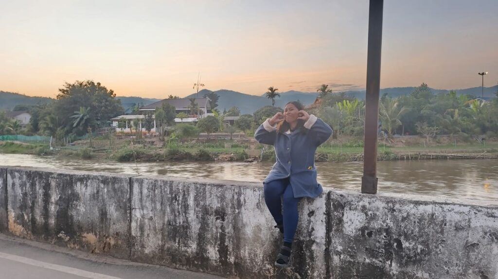
Back in Chiang Mai
You’ll probably feel weird being back in traffic. It’s only been 5 days since you left, but it will feel like an eternity.
You’ve done 500+ kilometers, maybe gotten a slight helmet tan. Congratulations, you’ve looped Mae Hong Son!
Logistics of the Mae Hong Son Loop
Here’s the important stuff. If I’ve missed something, it’s probably not that important – just wing it!
Motorbike Rental
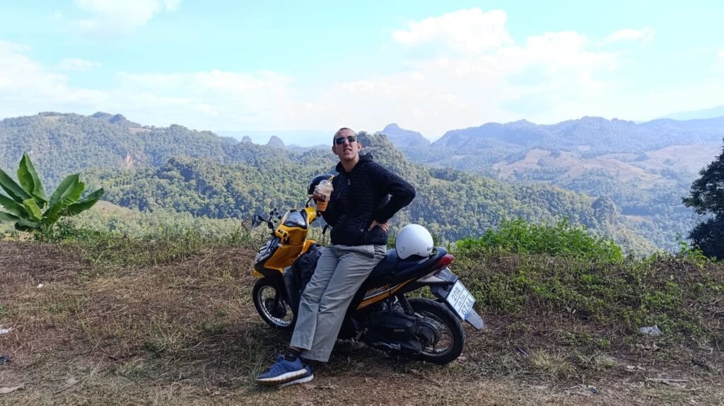
Chiang Mai is packed with rental shops, from chain outfits to corner garages. You’ll have your pick of semi-automatic, manual, or automatic bikes. For the full loop, you’ll want something with a bit of power.
If you’re going solo, 110cc may be enough, though I do not recommend it. Go for a minimum of 125cc. A 150-250cc is even better, especially if hauling a lot of gear, but also noticeably more expensive to rent.
I rented a 125cc from Mai Phare – one of the most well-rated shops in Chiang Mai. The daily price was 250 THB/day (after a multi-day discount) with a 3000 THB deposit, promptly refunded on motorcycle return.
Do NOT leave your passport as a deposit, and remember to take photos/short video of the bike before you go!
Road Conditions
The roads were much better than I had expected.
The entire loop is fully paved, and most stretches are in excellent condition, particularly the highway segments and main tourist routes.
That said:
- Expect sharp turns, steep climbs, and the occasional gravel patch on side detours.
- Route 4009 and 1263 (the scenic cut to Mae Chaem) are more remote and narrower, but the surface is new and clean.
- Riding early? Watch for fog, morning dew, and slippery leaves.
- Don’t try the smaller roads south of Doi Inthanon, unless you’re in for an off-road adventure.
Fuel
Fuel is easy to find in most towns (Pai, Mae Hong Son, Mae Chaem, Mae Sariang, Chom Thong).
In between, you’ll spot roadside fuel bottles – 1L glass bottles of petrol, sold from wooden stands or someone’s front porch.
Fill up before leaving each major stop.
For example, the 4009 does not have fuel stations, and you may find it difficult to find roadside vendors too!
Fuel costs around 35-40 THB per liter. One liter lasts around 40-50 km, less if going uphill.
Police on the Loop
I didn’t encounter any police, but they do sometimes set up roadblocks and check papers.
It’s most common on the exits of Chiang Pai and on the road towards Pai.
Legally speaking, you need an international driver’s licence for category A (motorcycles). But the law in Thailand is a bit lax, and the penalty if caught without a licence is a measly 500 THB.
Weather & Seasons
- Best time to ride: November to February: dry, cool, and clear skies.
- Hot season (March–May): Dry and dusty, sometimes smoky from field burning.
- Rainy season (June–October): Expect slippery roads, landslides, and fog, but also lush scenery.
Money, ATMs & Cards
- ATMs available in Chiang Mai, Pai, Mae Hong Son, and Mae Sariang.
- Some hostels and restaurants take cards, but don’t count on it. When booking online, most accommodations accept online pre-payment.
- Carry at least 750 THB per person per day in cash – you probably won’t need that much, but better safe than sorry.
Check out this guide to money in Thailand for more details.
Gear & Packing
- Essentials: Poncho, gloves, long sleeves, sunscreen, reusable water bottle
- Clothing: Layers! Doi Inthanon gets cold, especially in the morning! Driving itself is cold! I had to buy long pants as it was getting unbearably cold!
- Helmet: Always wear one. Any self-respecting rental shop will have a stock for you to choose from. Opt for a full helmet with a visor.
Safety & Accidents
- Ride defensively – pickup trucks and minivans cut corners.
- Don’t ride after dark if you can avoid it (potholes + dogs + trucks = bad combo)
- In case of accident:
- Most towns have clinics or hospitals
- For major issues, head back to Chiang Mai
- Have travel insurance that covers motorbike riding (and check the fine print)
- If you’ve caused property damage, better to sort it out with the person directly than to involve the police.
- Do not fix bikes without consulting your rental first. Flat tires are exempt, though still, it wouldn’t hurt to inform beforehand.
Insurance
If you’re traveling, chances are that you already have one. Just make sure you are covered for traffic accidents in the insurance policy.
I use SafetyWing and so far everything has been top-notch. It covers motorcycle accidents as long as you drive legally and with the proper safety equipment (e.g., a helmet).
Other Ways to Do the Mae Hong Son Loop
- Minivan (a.k.a. The Vomit Comet): Minivans connect Chiang Mai to Pai, Mae Hong Son, and Mae Sariang daily. They’re fast, affordable, and often terrifying. Book via 12Go or a local agency.
- Rental Car: Comfortable but much more expensive than a motorcycle (>1000 THB/day). And you can’t feel the wind.
- Local Bus: Cheap but slow and unpredictable. Not recommended.
- Bicycle (For Masochists Only): Got legs of steel? Then why not? People do it, but it’s not for the faint of heart.
- Guided tours and treks (but not looping): If you want to just visit Doi Inthanon, it makes sense, but not for the whole Mae Hong Son Loop.
(In)frequently Asked Questions
Should you loop clockwise or counter-clockwise?
Clockwise (Chiang Mai → Pai → Mae Hong Son → Mae Chaem→ Doi Inthanon → back) is the most common way. The climbs are gentler and the visibility on corners is better.
Counter-clockwise is totally doable though.
Do I need an international driver’s license?
Yes, technically you do, but the penalty if caught without is only 500 THB.
The important question is – can you really drive well?
Also, insurance normally does not cover driving without a proper license.
Is it safe to ride solo?
Yes, totally. This is one of the safest places in Southeast Asia to ride solo.
Can I leave my luggage in Chiang Mai?
Yes! Most rental shops and hostels offer free luggage storage while you’re out on the loop. Pack light for the road and leave the big backpack behind.
Is there any part of the loop that’s truly remote?
The stretch between Mae Hong Son and Mae Chaem via Routes 4009/1263 is the most remote and sees fewer tourists. Still, you’re never more than 30–40 km from some kind of village.
Can I do it on an automatic scooter?
Yes, and many people do. The roads are paved. Just expect a bit of a struggle on steeper climbs or when riding two-up. If you can handle a semi-auto or manual, you’ll have more control and better engine braking.
Is it too touristy now?
Parts of it are. Pai – definitely.
But much of the loop is still delightfully under-visited, especially the stretch between Mae Hong Son and Mae Sariang. The Mae Chaem route via 1263? Still wild and wonderful.
Check out these other motorcycle trips in Southeast Asia:
- Thakhek Loop in Laos
- Bolaven Plateau Loop in Laos
- Ha Giang Loop in Vietnam
- Hai Van Pass in Vietnam